Tennessee Landforms -- waterfalls| WGS84 |
| 36.454565 | -84.641903 |
| 36° 27.274'N | 84° 38.514'W |
| 36° 27' 16.4"N | 84° 38' 30.8"W |
| 16S 711321E 4036953N |
| convert to NAD27 |
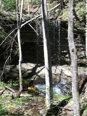
OnW Falls 25'
Waypoint: SCF041 36.454565,-84.641903
County: Scott landforms of Scott county
Locale: Big South Fork
popup list of
nearby landforms (mileage, bearing)
MAPS
Select one of the following maps to display this waypoint (WGS84).
GPS
Remarks:
Reference and photo: Chad Harrold
Tennessee landforms
home
arches
waterfalls
rocks
peaks
balds
sinks
lakes
regions
county
GSMNP landforms (TN/NC)
BSF landforms (TN/KY)
or nearby
lookout towers
 ©
Tom Dunigan
©
Tom Dunigan