Tennessee Landforms -- waterfalls| WGS84 |
| 36.381200 | -84.635300 |
| 36° 22.872'N | 84° 38.118'W |
| 36° 22' 52.3"N | 84° 38' 7.1"W |
| 16S 712112E 4028828N |
| convert to NAD27 |
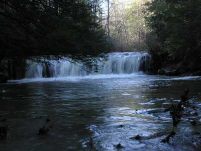
Skull Creek Falls 9'
Waypoint: SCF021 36.381200,-84.635300
County: Scott landforms of Scott county
Locale: Big South Fork
popup list of
nearby landforms (mileage, bearing)
MAPS
Select one of the following maps to display this waypoint (WGS84).
GPS
Remarks:
manway
Tennessee landforms
home
arches
waterfalls
rocks
peaks
balds
sinks
lakes
regions
county
GSMNP landforms (TN/NC)
BSF landforms (TN/KY)
or nearby
lookout towers
 ©
Tom Dunigan
©
Tom Dunigan