Tennessee Landforms -- waterfalls| WGS84 |
| 36.525400 | -84.665000 |
| 36° 31.524'N | 84° 39.9'W |
| 36° 31' 31.4"N | 84° 39' 54"W |
| 16S 709060E 4044762N |
| convert to NAD27 |
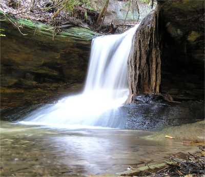
Root Falls 8'
Waypoint: SCF013 36.525400,-84.665000
County: Scott landforms of Scott county
Locale: Big South Fork
popup list of
nearby landforms (mileage, bearing)
MAPS
Select one of the following maps to display this waypoint (WGS84).
GPS
Remarks:
A mass of roots looks like a petrified falls in this dark alcove.
off-trail
Tennessee landforms
home
arches
waterfalls
rocks
peaks
balds
sinks
lakes
regions
county
GSMNP landforms (TN/NC)
BSF landforms (TN/KY)
or nearby
lookout towers
 ©
Tom Dunigan
©
Tom Dunigan