Tennessee Landforms -- waterfalls| WGS84 |
| 36.430060 | -84.653700 |
| 36° 25.804'N | 84° 39.222'W |
| 36° 25' 48.2"N | 84° 39' 13.3"W |
| 16S 710330E 4034208N |
| convert to NAD27 |
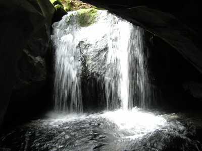
Boulder House Falls 12'
Waypoint: SCF003 36.430060,-84.653700
County: Scott landforms of Scott county
Locale: Big South Fork
popup list of
nearby landforms (mileage, bearing)
MAPS
Select one of the following maps to display this waypoint (WGS84).
GPS
Remarks:
Honey Creek trail
Tennessee landforms
home
arches
waterfalls
rocks
peaks
balds
sinks
lakes
regions
county
GSMNP landforms (TN/NC)
BSF landforms (TN/KY)
or nearby
lookout towers
 ©
Tom Dunigan
©
Tom Dunigan