Tennessee Landforms -- arches and natural bridges| WGS84 |
| 36.450600 | -84.661900 |
| 36° 27.036'N | 84° 39.714'W |
| 36° 27' 2.2"N | 84° 39' 42.8"W |
| 16S 709539E 4036469N |
| convert to NAD27 |
Diocese Arch 4x3
Waypoint: SCA045 36.450600,-84.661900
County: Scott landforms of Scott county
Locale: Big South Fork
NABSQNO 16S-709539-4036469
popup list of
nearby landforms (mileage, bearing)
MAPS
Select one of the following maps to display this waypoint (WGS84).
GPS
Remarks:
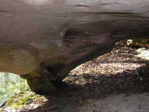 just above horse trail
Tennessee landforms
home
arches
waterfalls
rocks
peaks
balds
sinks
lakes
regions
county
GSMNP landforms (TN/NC)
BSF landforms (TN/KY)
or nearby
lookout towers
 ©
Tom Dunigan
©
Tom Dunigan