Tennessee Landforms -- arches and natural bridges| WGS84 |
| 36.405660 | -84.462930 |
| 36° 24.34'N | 84° 27.776'W |
| 36° 24' 20.4"N | 84° 27' 46.6"W |
| 16S 727505E 4031934N |
| convert to NAD27 |
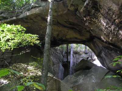
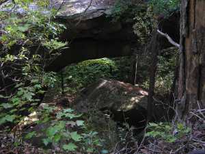
Huntsville Arch 55x30
Waypoint: SCA034 36.405660,-84.462930
County: Scott landforms of Scott county
Locale: private
NABSQNO 16S-727505-4031934
popup list of
nearby landforms (mileage, bearing)
MAPS
Select one of the following maps to display this waypoint (WGS84).
GPS
Remarks:
Reference: Keith Garnes, Tom Des Jean
Tennessee landforms
home
arches
waterfalls
rocks
peaks
balds
sinks
lakes
regions
county
GSMNP landforms (TN/NC)
BSF landforms (TN/KY)
or nearby
lookout towers
 ©
Tom Dunigan
©
Tom Dunigan