Tennessee Landforms -- arches and natural bridges| WGS84 |
| 36.580000 | -84.677600 |
| 36° 34.8'N | 84° 40.656'W |
| 36° 34' 48"N | 84° 40' 39.4"W |
| 16S 707786E 4050792N |
| convert to NAD27 |
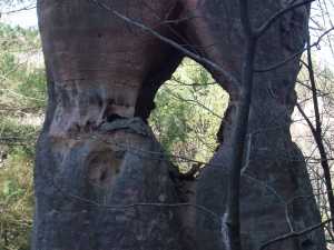
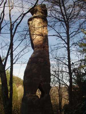
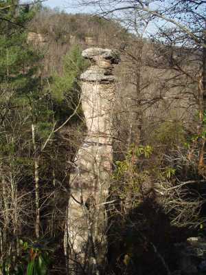
Cap Rock Window 2x3
Waypoint: SCA021 36.580000,-84.677600
County: Scott landforms of Scott county
Locale: Big South Fork
NABSQNO 16S-707786-4050792
popup list of
nearby landforms (mileage, bearing)
MAPS
Select one of the following maps to display this waypoint (WGS84).
GPS
Remarks:
References: JNAD:TENN-73,Bob Wheeley
A small window in this 45' spire. off-trail
Tennessee landforms
home
arches
waterfalls
rocks
peaks
balds
sinks
lakes
regions
county
GSMNP landforms (TN/NC)
BSF landforms (TN/KY)
or nearby
lookout towers
 ©
Tom Dunigan
©
Tom Dunigan