| WGS84 | |
| 36.547500 | -84.728400 |
| 36° 32.85'N | 84° 43.704'W |
| 36° 32' 51"N | 84° 43' 42.2"W |
| 16S 703325E 4047078N | |
| convert to NAD27 | |
MAPS
Select one of the following maps to display this waypoint (WGS84).
GPS
Remarks:
References: JNAD:TENN-37, WAD:44.49, JNAD 23, John Burns
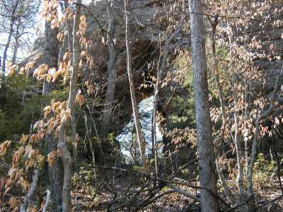
The arch is about 150' west of the trail (close to an old roadbed). There are some small archettes (column arches) just where you leave the trail (TENN-76, Fife). Some arches are also reported east across the drainage (TENN-38) high on the bluff line.