Tennessee Landforms -- waterfalls| WGS84 |
| 35.852730 | -84.382500 |
| 35° 51.164'N | 84° 22.95'W |
| 35° 51' 9.8"N | 84° 22' 57"W |
| 16S 736373E 3970778N |
| convert to NAD27 |
Mill Creek Cascade 15'
Waypoint: ROF002 35.852730,-84.382500
County: Roane landforms of Roane county
Locale: private
popup list of
nearby landforms (mileage, bearing)
MAPS
Select one of the following maps to display this waypoint (WGS84).
GPS
Remarks:
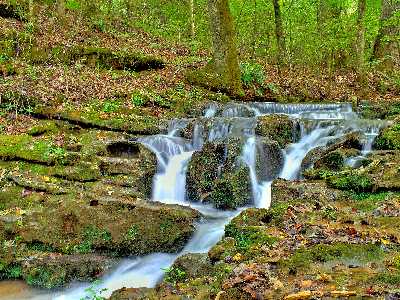 Chris Oliver photo
Tennessee landforms
home
arches
waterfalls
rocks
peaks
balds
sinks
lakes
regions
county
GSMNP landforms (TN/NC)
BSF landforms (TN/KY)
or nearby
lookout towers
 ©
Tom Dunigan
©
Tom Dunigan