Tennessee Landforms -- arches and natural bridges| WGS84 |
| 35.861300 | -84.370000 |
| 35° 51.678'N | 84° 22.2'W |
| 35° 51' 40.7"N | 84° 22' 12"W |
| 16S 737476E 3971759N |
| convert to NAD27 |
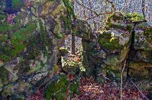
Tate's Arch 10x8
Waypoint: ROA005 35.861300,-84.370000
County: Roane landforms of Roane county
Locale: private
NABSQNO 16S-737476-3971759
popup list of
nearby landforms (mileage, bearing)
MAPS
Select one of the following maps to display this waypoint (WGS84).
GPS
Remarks:
just upstream is Tate's Natural Bridge
and a few more smaller spans sprinkled around.
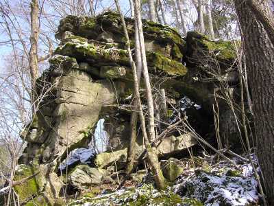
 courtesy Chris Oliver
Tennessee landforms
home
arches
waterfalls
rocks
peaks
balds
sinks
lakes
regions
county
GSMNP landforms (TN/NC)
BSF landforms (TN/KY)
or nearby
lookout towers
 ©
Tom Dunigan
©
Tom Dunigan