Tennessee Landforms -- arches and natural bridges| WGS84 |
| 35.883460 | -84.487660 |
| 35° 53.008'N | 84° 29.26'W |
| 35° 53' 0.5"N | 84° 29' 15.6"W |
| 16S 726787E 3973938N |
| convert to NAD27 |
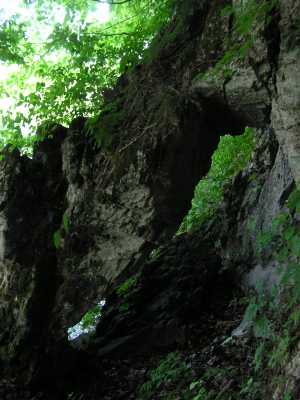
Kingston Arch 6x8
Waypoint: ROA003 35.883460,-84.487660
County: Roane landforms of Roane county
NABSQNO 16S-726787-3973938
popup list of
nearby landforms (mileage, bearing)
MAPS
Select one of the following maps to display this waypoint (WGS84).
GPS
Remarks:
just a few feet above the lake in a limestone cliff, access by boat.
Tennessee landforms
home
arches
waterfalls
rocks
peaks
balds
sinks
lakes
regions
county
GSMNP landforms (TN/NC)
BSF landforms (TN/KY)
or nearby
lookout towers
 ©
Tom Dunigan
©
Tom Dunigan