| WGS84 | |
| 35.684781 | -84.907460 |
| 35° 41.087'N | 84° 54.448'W |
| 35° 41' 5.2"N | 84° 54' 26.9"W |
| 16S 689357E 3951005N | |
| convert to NAD27 | |
MAPS
Select one of the following maps to display this waypoint (WGS84).
GPS
Remarks:
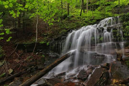
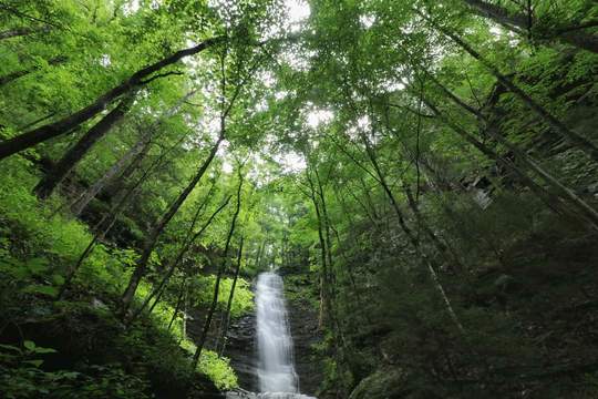
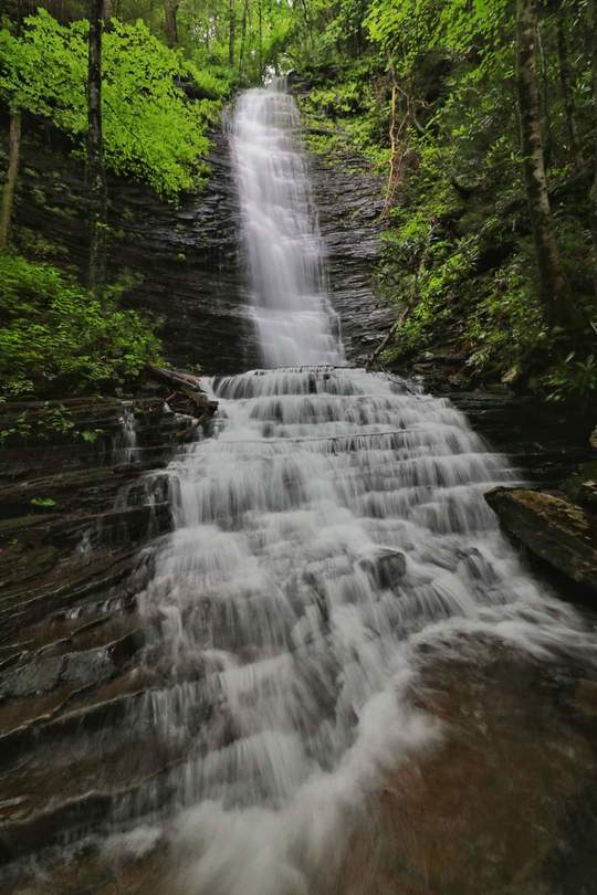
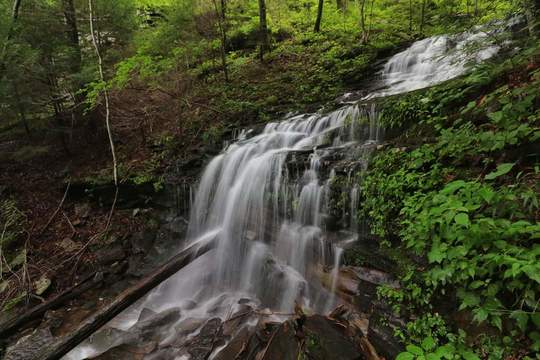
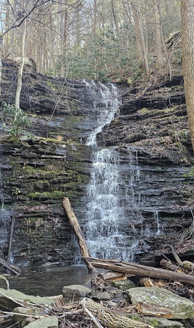
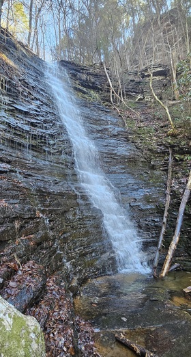
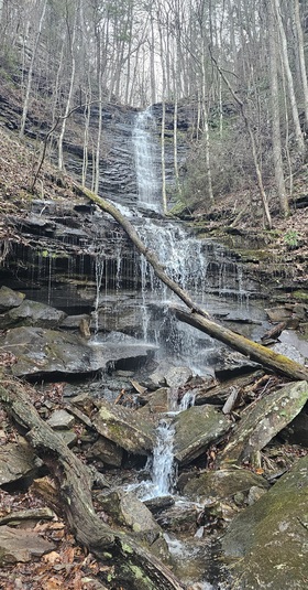
Reference and photos: Shauna Wilson
In 2024 Shauna writes: "We are building a stretch of the Cumberland Trail in Piney Creek gorge and we worked past a huge fall this week. The fall is located at 35.684781', -84.90746'. It is a multi drop fall with several sets of cascades as well. One of my crew members and I climbed up some sketchy stuff yesterday to measure it. The top drop is about 50 feet and is completely out of view from the trail. The second major drop is 70 feet (the first one visible from the trail). Then there's about 20 feet of cascades leading to another 20 foot drop. (All visible uphill of the trail). The last drop is about 40 feet into Piney Creek. (No photo of the final drop as I could not find a way down yesterday). It's about a 200 footer and we'd like to call it Fossil Falls."
----------------
Brian Solomon's 2016 photos: