Tennessee Landforms -- waterfalls| WGS84 |
| 35.526672 | -85.047078 |
| 35° 31.6'N | 85° 2.825'W |
| 35° 31' 36"N | 85° 2' 49.5"W |
| 16S 677069E 3933205N |
| convert to NAD27 |
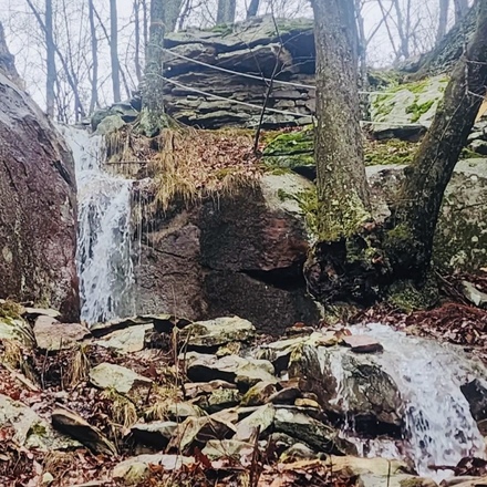
Green Sally Falls 18'
Waypoint: RHF039 35.526672,-85.047078
County: Rhea landforms of Rhea county
Locale: CT
popup list of
nearby landforms (mileage, bearing)
MAPS
Select one of the following maps to display this waypoint (WGS84).
GPS
Remarks:
Reference and photo: Shauna Wilson
Tennessee landforms
home
arches
waterfalls
rocks
peaks
balds
sinks
lakes
regions
county
GSMNP landforms (TN/NC)
BSF landforms (TN/KY)
or nearby
lookout towers
 ©
Tom Dunigan
©
Tom Dunigan