Tennessee Landforms -- waterfalls| WGS84 |
| 35.475899 | -85.117046 |
| 35° 28.554'N | 85° 7.023'W |
| 35° 28' 33.2"N | 85° 7' 1.4"W |
| 16S 670832E 3927450N |
| convert to NAD27 |
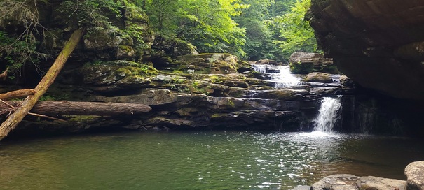
Chelsea Falls 14'
Waypoint: RHF036 35.475899,-85.117046
County: Rhea landforms of Rhea county
popup list of
nearby landforms (mileage, bearing)
MAPS
Select one of the following maps to display this waypoint (WGS84).
GPS
Remarks:
Reference and photo: Ryan Gardner
Tennessee landforms
home
arches
waterfalls
rocks
peaks
balds
sinks
lakes
regions
county
GSMNP landforms (TN/NC)
BSF landforms (TN/KY)
or nearby
lookout towers
 ©
Tom Dunigan
©
Tom Dunigan