Tennessee Landforms -- waterfalls| WGS84 |
| 35.467355 | -85.111045 |
| 35° 28.041'N | 85° 6.663'W |
| 35° 28' 2.5"N | 85° 6' 39.8"W |
| 16S 671395E 3926513N |
| convert to NAD27 |
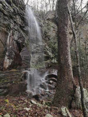
Brayton Mtn Falls 55'
Waypoint: RHF034 35.467355,-85.111045
County: Rhea landforms of Rhea county
Locale: CT
popup list of
nearby landforms (mileage, bearing)
MAPS
Select one of the following maps to display this waypoint (WGS84).
GPS
Remarks:
Reference and photos: Brian Solomon
off-trail wet-weather falls, with 2 smaller falls downstream at 35.467377,-85.110748
Tennessee landforms
home
arches
waterfalls
rocks
peaks
balds
sinks
lakes
regions
county
GSMNP landforms (TN/NC)
BSF landforms (TN/KY)
or nearby
lookout towers
 ©
Tom Dunigan
©
Tom Dunigan