Tennessee Landforms -- waterfalls| WGS84 |
| 35.703286 | -84.913015 |
| 35° 42.197'N | 84° 54.781'W |
| 35° 42' 11.8"N | 84° 54' 46.9"W |
| 16S 688810E 3953047N |
| convert to NAD27 |
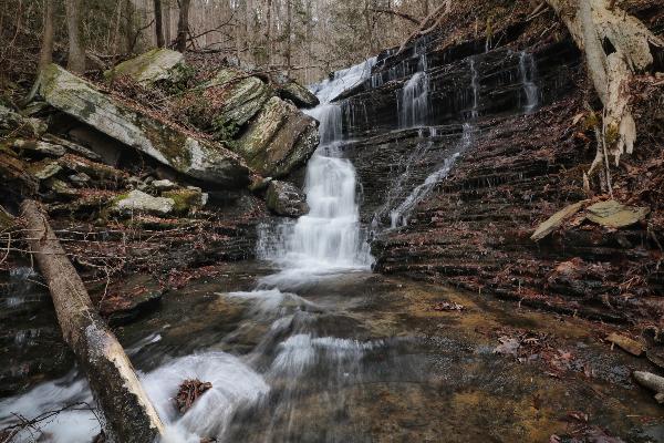
Pine Br Falls(2) 30'
Waypoint: RHF031 35.703286,-84.913015
County: Rhea landforms of Rhea county
Locale: CT
popup list of
nearby landforms (mileage, bearing)
MAPS
Select one of the following maps to display this waypoint (WGS84).
GPS
Remarks:
Reference and photos: Brian Solomon
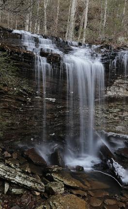 upper
upper
Tennessee landforms
home
arches
waterfalls
rocks
peaks
balds
sinks
lakes
regions
county
GSMNP landforms (TN/NC)
BSF landforms (TN/KY)
or nearby
lookout towers
 ©
Tom Dunigan
©
Tom Dunigan