Tennessee Landforms -- waterfalls| WGS84 |
| 35.539200 | -85.038100 |
| 35° 32.352'N | 85° 2.286'W |
| 35° 32' 21.1"N | 85° 2' 17.2"W |
| 16S 677856E 3934611N |
| convert to NAD27 |
North Pole Falls 17'
Waypoint: RHF014 35.539200,-85.038100
County: Rhea landforms of Rhea county
Locale: PktWldns
popup list of
nearby landforms (mileage, bearing)
MAPS
Select one of the following maps to display this waypoint (WGS84).
GPS
Remarks:
Off-trail on Morgan's Creek below Snow Falls, see
whitewater info
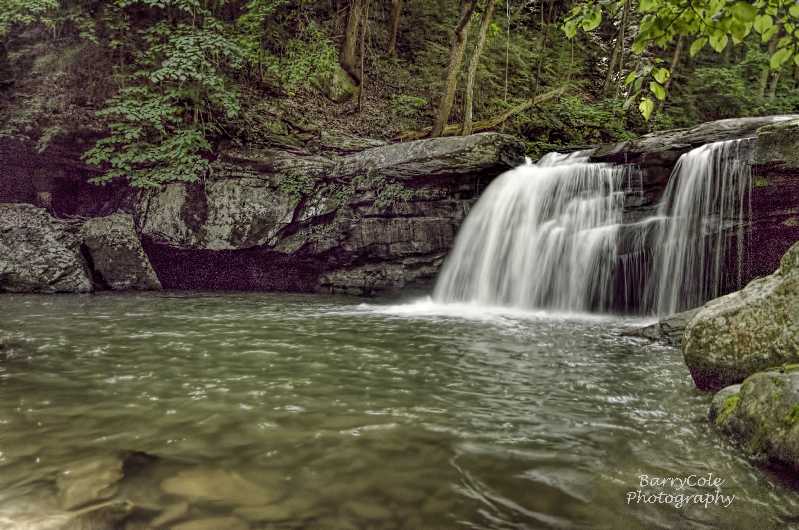 Barry Cole photo
Tennessee landforms
home
arches
waterfalls
rocks
peaks
balds
sinks
lakes
regions
county
GSMNP landforms (TN/NC)
BSF landforms (TN/KY)
or nearby
lookout towers
 ©
Tom Dunigan
©
Tom Dunigan