Tennessee Landforms -- waterfalls| WGS84 |
| 35.686800 | -84.934000 |
| 35° 41.208'N | 84° 56.04'W |
| 35° 41' 12.5"N | 84° 56' 2.4"W |
| 16S 686950E 3951178N |
| convert to NAD27 |
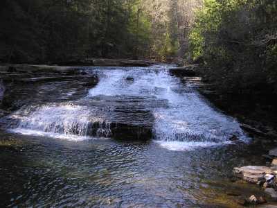
White Pine Cascades 28'
Waypoint: RHF011 35.686800,-84.934000
County: Rhea landforms of Rhea county
Locale: Cumberland Trail
popup list of
nearby landforms (mileage, bearing)
MAPS
Select one of the following maps to display this waypoint (WGS84).
GPS
Remarks:
along
Piney River Trail
Tennessee landforms
home
arches
waterfalls
rocks
peaks
balds
sinks
lakes
regions
county
GSMNP landforms (TN/NC)
BSF landforms (TN/KY)
or nearby
lookout towers
 ©
Tom Dunigan
©
Tom Dunigan