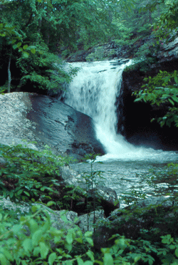
 Photo by Gregory Plumb, Author of
Waterfalls of Tennessee
Photo by Gregory Plumb, Author of
Waterfalls of Tennessee
| WGS84 | |
| 35.546670 | -85.038610 |
| 35° 32.8'N | 85° 2.317'W |
| 35° 32' 48"N | 85° 2' 19"W |
| 16S 677793E 3935439N | |
| convert to NAD27 | |
MAPS
Select one of the following maps to display this waypoint (WGS84).
GPS
Remarks:
See CT trail map. Nearby is Laurel Falls and Gooch Creek Arch
Photo by Gregory Plumb, Author of
Waterfalls of Tennessee