Tennessee Landforms -- waterfalls| WGS84 |
| 35.781110 | -84.842220 |
| 35° 46.867'N | 84° 50.533'W |
| 35° 46' 52"N | 84° 50' 32"W |
| 16S 695026E 3961819N |
| convert to NAD27 |
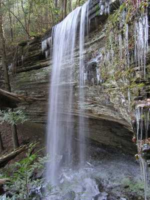
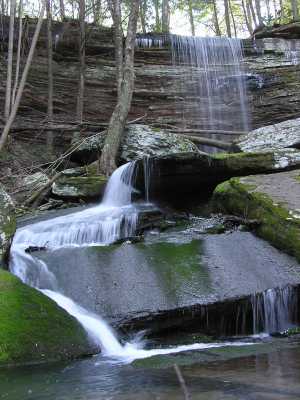
Ray Falls 40'
Waypoint: RHF007 35.781110,-84.842220
County: Rhea landforms of Rhea county
Locale: private
popup list of
nearby landforms (mileage, bearing)
MAPS
Select one of the following maps to display this waypoint (WGS84).
GPS
Remarks:
Tennessee landforms
home
arches
waterfalls
rocks
peaks
balds
sinks
lakes
regions
county
GSMNP landforms (TN/NC)
BSF landforms (TN/KY)
or nearby
lookout towers
 ©
Tom Dunigan
©
Tom Dunigan