Tennessee Landforms -- waterfalls| WGS84 |
| 36.119820 | -85.267850 |
| 36° 7.189'N | 85° 16.071'W |
| 36° 7' 11.3"N | 85° 16' 4.3"W |
| 16S 655885E 3998628N |
| convert to NAD27 |
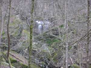
Verble Falls 30'
Waypoint: PUF014 36.119820,-85.267850
County: Putnam landforms of Putnam county
Locale: private
popup list of
nearby landforms (mileage, bearing)
MAPS
Select one of the following maps to display this waypoint (WGS84).
GPS
Remarks:
Tennessee landforms
home
arches
waterfalls
rocks
peaks
balds
sinks
lakes
regions
county
GSMNP landforms (TN/NC)
BSF landforms (TN/KY)
or nearby
lookout towers
 ©
Tom Dunigan
©
Tom Dunigan