Tennessee Landforms -- waterfalls| WGS84 |
| 36.039478 | -85.249073 |
| 36° 2.369'N | 85° 14.944'W |
| 36° 2' 22.1"N | 85° 14' 56.6"W |
| 16S 657736E 3989745N |
| convert to NAD27 |
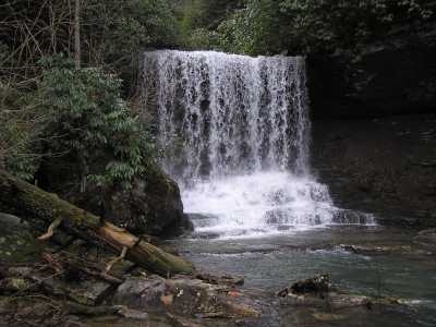
Devils Creek Falls 30'
Waypoint: PUF013 36.039478,-85.249073
County: Putnam landforms of Putnam county
Locale: private
popup list of
nearby landforms (mileage, bearing)
MAPS
Select one of the following maps to display this waypoint (WGS84).
GPS
Remarks:
more
info
or here
Tennessee landforms
home
arches
waterfalls
rocks
peaks
balds
sinks
lakes
regions
county
GSMNP landforms (TN/NC)
BSF landforms (TN/KY)
or nearby
lookout towers
 ©
Tom Dunigan
©
Tom Dunigan