Tennessee Landforms -- waterfalls| WGS84 |
| 36.041549 | -85.248775 |
| 36° 2.493'N | 85° 14.926'W |
| 36° 2' 29.6"N | 85° 14' 55.6"W |
| 16S 657759E 3989976N |
| convert to NAD27 |
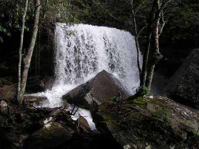
Bridge Creek Falls 30'
Waypoint: PUF008 36.041549,-85.248775
County: Putnam landforms of Putnam county
Locale: private
popup list of
nearby landforms (mileage, bearing)
MAPS
Select one of the following maps to display this waypoint (WGS84).
GPS
Remarks:
more
info
or here
and
photo
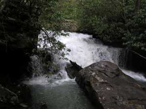 upper falls 20' at
36.04268,-85.24848
upper falls 20' at
36.04268,-85.24848
Tennessee landforms
home
arches
waterfalls
rocks
peaks
balds
sinks
lakes
regions
county
GSMNP landforms (TN/NC)
BSF landforms (TN/KY)
or nearby
lookout towers
 ©
Tom Dunigan
©
Tom Dunigan