Tennessee Landforms -- waterfalls| WGS84 |
| 35.133910 | -84.597880 |
| 35° 8.035'N | 84° 35.873'W |
| 35° 8' 2.1"N | 84° 35' 52.4"W |
| 16S 718862E 3890535N |
| convert to NAD27 |
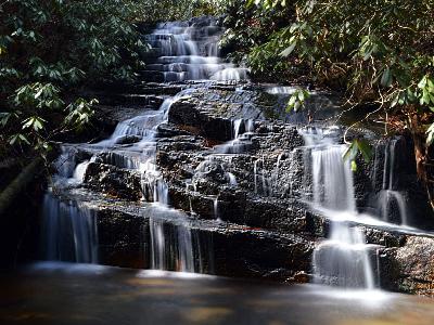
Sleeping Owl Falls 25'
Waypoint: POF028 35.133910,-84.597880
County: Polk landforms of Polk county
Locale: Cherokee National Forest
popup list of
nearby landforms (mileage, bearing)
MAPS
Select one of the following maps to display this waypoint (WGS84).
GPS
Remarks:
Reference: Christopher Lewis
 Daniel Jack Hutchison photo
Tennessee landforms
home
arches
waterfalls
rocks
peaks
balds
sinks
lakes
regions
county
GSMNP landforms (TN/NC)
BSF landforms (TN/KY)
or nearby
lookout towers
 ©
Tom Dunigan
©
Tom Dunigan