Tennessee Landforms -- waterfalls| WGS84 |
| 35.132660 | -84.594730 |
| 35° 7.96'N | 84° 35.684'W |
| 35° 7' 57.6"N | 84° 35' 41"W |
| 16S 719152E 3890403N |
| convert to NAD27 |
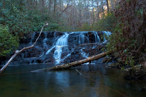
Phoenix Falls 8'
Waypoint: POF025 35.132660,-84.594730
County: Polk landforms of Polk county
Locale: Cherokee National Forest
popup list of
nearby landforms (mileage, bearing)
MAPS
Select one of the following maps to display this waypoint (WGS84).
GPS
Remarks:
Reference and photo: Michael Shannon
Tennessee landforms
home
arches
waterfalls
rocks
peaks
balds
sinks
lakes
regions
county
GSMNP landforms (TN/NC)
BSF landforms (TN/KY)
or nearby
lookout towers
 ©
Tom Dunigan
©
Tom Dunigan