Tennessee Landforms -- waterfalls| WGS84 |
| 35.130170 | -84.593550 |
| 35° 7.81'N | 84° 35.613'W |
| 35° 7' 48.6"N | 84° 35' 36.8"W |
| 16S 719266E 3890129N |
| convert to NAD27 |
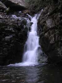
Thornburg Ridge Falls 25'
Waypoint: POF009 35.130170,-84.593550
County: Polk landforms of Polk county
Locale: Cherokee National Forest
popup list of
nearby landforms (mileage, bearing)
MAPS
Select one of the following maps to display this waypoint (WGS84).
GPS
Remarks:
Hike up Scenic Spur Trail then off-trail up the creek.
(see trail maps)
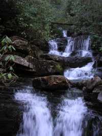
 upper falls
rock slab bridge at top of upper falls
Tennessee landforms
home
arches
waterfalls
rocks
peaks
balds
sinks
lakes
regions
county
GSMNP landforms (TN/NC)
BSF landforms (TN/KY)
or nearby
lookout towers
 ©
Tom Dunigan
©
Tom Dunigan