and Dutch Roth 1938 photo
| WGS84 | |
| 35.140480 | -84.596100 |
| 35° 8.429'N | 84° 35.766'W |
| 35° 8' 25.7"N | 84° 35' 46"W |
| 16S 719006E 3891267N | |
| convert to NAD27 | |
MAPS
Select one of the following maps to display this waypoint (WGS84).
GPS
Remarks:
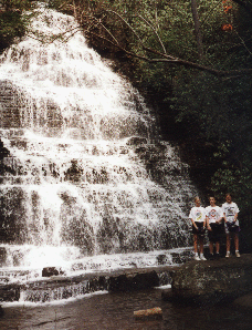
CNF trail 131 and bike trail
and Dutch Roth 1938
photo
There are several more falls along this creek before it reaches the lake.