Tennessee Landforms -- waterfalls| WGS84 |
| 36.576919 | -84.779025 |
| 36° 34.615'N | 84° 46.742'W |
| 36° 34' 36.9"N | 84° 46' 44.5"W |
| 16S 698718E 4050236N |
| convert to NAD27 |
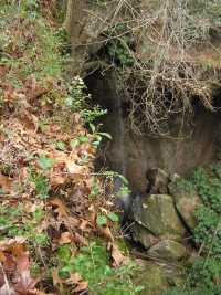
West Fork Falls 30'
Waypoint: PIF006 36.576919,-84.779025
County: Pickett landforms of Pickett county
Locale: forest
popup list of
nearby landforms (mileage, bearing)
MAPS
Select one of the following maps to display this waypoint (WGS84).
GPS
Remarks:
along Hidden Passage trail, wet-weather falls
Tennessee landforms
home
arches
waterfalls
rocks
peaks
balds
sinks
lakes
regions
county
GSMNP landforms (TN/NC)
BSF landforms (TN/KY)
or nearby
lookout towers
 ©
Tom Dunigan
©
Tom Dunigan