Tennessee Landforms -- arches and natural bridges| WGS84 |
| 36.611140 | -84.979420 |
| 36° 36.668'N | 84° 58.765'W |
| 36° 36' 40.1"N | 84° 58' 45.9"W |
| 16S 680706E 4053637N |
| convert to NAD27 |
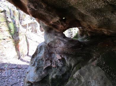
Wildfire Arch 6x2
Waypoint: PIA053 36.611140,-84.979420
County: Pickett landforms of Pickett county
NABSQNO 16S-680706-4053637
popup list of
nearby landforms (mileage, bearing)
MAPS
Select one of the following maps to display this waypoint (WGS84).
GPS
Remarks:
Reference and photo: Michael Bose
Tennessee landforms
home
arches
waterfalls
rocks
peaks
balds
sinks
lakes
regions
county
GSMNP landforms (TN/NC)
BSF landforms (TN/KY)
or nearby
lookout towers
 ©
Tom Dunigan
©
Tom Dunigan