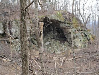
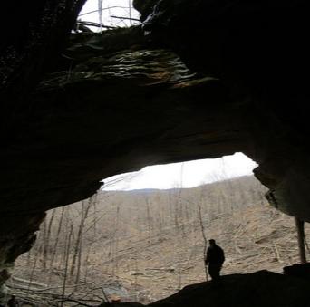
This arch was found by Pat Erisman while acting off a Lidar lead. The upper opening is more like a pit or cave entrance.
| WGS84 | |
| 36.613400 | -84.977270 |
| 36° 36.804'N | 84° 58.636'W |
| 36° 36' 48.2"N | 84° 58' 38.2"W |
| 16S 680893E 4053892N | |
| convert to NAD27 | |
MAPS
Select one of the following maps to display this waypoint (WGS84).
GPS
Remarks:
Reference and photo: Michael Bose
This arch was found by Pat Erisman while acting off a Lidar lead.
The upper opening is more like a pit or cave entrance.