Tennessee Landforms -- arches and natural bridges| WGS84 |
| 36.584580 | -84.843820 |
| 36° 35.075'N | 84° 50.629'W |
| 36° 35' 4.5"N | 84° 50' 37.7"W |
| 16S 692900E 4050954N |
| convert to NAD27 |
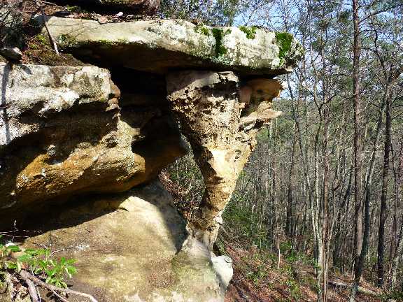
Tornado Arch 3x6
Waypoint: PIA045 36.584580,-84.843820
County: Pickett landforms of Pickett county
NABSQNO 16S-692900-4050954
popup list of
nearby landforms (mileage, bearing)
MAPS
Select one of the following maps to display this waypoint (WGS84).
GPS
Remarks:
Coordinates and photo courtesy of Ken Pasternack.
Tennessee landforms
home
arches
waterfalls
rocks
peaks
balds
sinks
lakes
regions
county
GSMNP landforms (TN/NC)
BSF landforms (TN/KY)
or nearby
lookout towers
 ©
Tom Dunigan
©
Tom Dunigan