Tennessee Landforms -- arches and natural bridges| WGS84 |
| 36.527600 | -84.754400 |
| 36° 31.656'N | 84° 45.264'W |
| 36° 31' 39.4"N | 84° 45' 15.8"W |
| 16S 701049E 4044815N |
| convert to NAD27 |
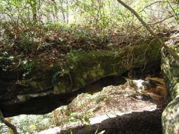
Exit Arch 30x11
Waypoint: PIA036 36.527600,-84.754400
County: Pickett landforms of Pickett county
Locale: Big South Fork
NABSQNO 16S-701049-4044815
popup list of
nearby landforms (mileage, bearing)
MAPS
Select one of the following maps to display this waypoint (WGS84).
GPS
Remarks:
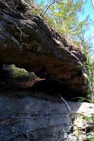 reference and photo courtesy of Todd Fife
Tennessee landforms
home
arches
waterfalls
rocks
peaks
balds
sinks
lakes
regions
county
GSMNP landforms (TN/NC)
BSF landforms (TN/KY)
or nearby
lookout towers
 ©
Tom Dunigan
©
Tom Dunigan