Tennessee Landforms -- arches and natural bridges| WGS84 |
| 36.533000 | -84.742550 |
| 36° 31.98'N | 84° 44.553'W |
| 36° 31' 58.8"N | 84° 44' 33.2"W |
| 16S 702096E 4045439N |
| convert to NAD27 |
Crinkled Arch 6x4
Waypoint: PIA034 36.533000,-84.742550
County: Pickett landforms of Pickett county
Locale: Big South Fork
NABSQNO 16S-702096-4045439
popup list of
nearby landforms (mileage, bearing)
MAPS
Select one of the following maps to display this waypoint (WGS84).
GPS
Remarks:
off-trail
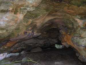
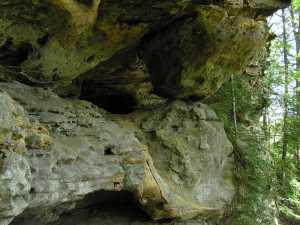 4x3 column arch high on the cliff wall
Tennessee landforms
home
arches
waterfalls
rocks
peaks
balds
sinks
lakes
regions
county
GSMNP landforms (TN/NC)
BSF landforms (TN/KY)
or nearby
lookout towers
 ©
Tom Dunigan
©
Tom Dunigan