Tennessee Landforms -- arches and natural bridges| WGS84 |
| 36.552885 | -84.800869 |
| 36° 33.173'N | 84° 48.052'W |
| 36° 33' 10.4"N | 84° 48' 3.1"W |
| 16S 696824E 4047525N |
| convert to NAD27 |
Pickett Lake Natural Bridge 30x35
Waypoint: PIA015 36.552885,-84.800869
County: Pickett landforms of Pickett county
Locale: state park
NABSQNO 16S-696824-4047525
popup list of
nearby landforms (mileage, bearing)
MAPS
Select one of the following maps to display this waypoint (WGS84).
GPS
Remarks:
References: JNAD:TENN-15, C/P:26
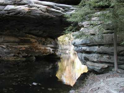
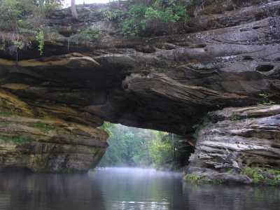
The oxbow in the creek suggests this to be an incise meander.
You can paddle to small arch on the feeder stream.
Tennessee landforms
home
arches
waterfalls
rocks
peaks
balds
sinks
lakes
regions
county
GSMNP landforms (TN/NC)
BSF landforms (TN/KY)
or nearby
lookout towers
 ©
Tom Dunigan
©
Tom Dunigan