Tennessee Landforms -- waterfalls| WGS84 |
| 36.208791 | -85.252333 |
| 36° 12.527'N | 85° 15.14'W |
| 36° 12' 31.6"N | 85° 15' 8.4"W |
| 16S 657104E 4008522N |
| convert to NAD27 |
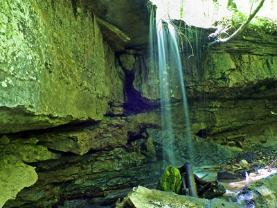
Obe Lee Falls 10'
Waypoint: OVF016 36.208791,-85.252333
County: Overton landforms of Overton county
popup list of
nearby landforms (mileage, bearing)
MAPS
Select one of the following maps to display this waypoint (WGS84).
GPS
Remarks:
wet-weather falls, photo courtesy of Chris Oliver
Tennessee landforms
home
arches
waterfalls
rocks
peaks
balds
sinks
lakes
regions
county
GSMNP landforms (TN/NC)
BSF landforms (TN/KY)
or nearby
lookout towers
 ©
Tom Dunigan
©
Tom Dunigan