Tennessee Landforms -- waterfalls| WGS84 |
| 36.304103 | -85.163363 |
| 36° 18.246'N | 85° 9.802'W |
| 36° 18' 14.8"N | 85° 9' 48.1"W |
| 16S 664902E 4019244N |
| convert to NAD27 |
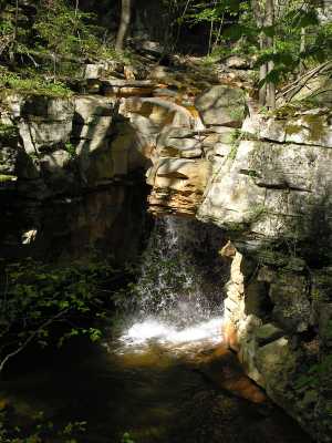
Orange Falls 15'
Waypoint: OVF012 36.304103,-85.163363
County: Overton landforms of Overton county
popup list of
nearby landforms (mileage, bearing)
MAPS
Select one of the following maps to display this waypoint (WGS84).
GPS
Remarks:

Tennessee landforms
home
arches
waterfalls
rocks
peaks
balds
sinks
lakes
regions
county
GSMNP landforms (TN/NC)
BSF landforms (TN/KY)
or nearby
lookout towers
 ©
Tom Dunigan
©
Tom Dunigan