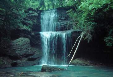 Photo by Gregory Plumb, Author of
Waterfalls of Tennessee
Photo by Gregory Plumb, Author of
Waterfalls of Tennessee
| WGS84 | |
| 35.447340 | -87.260970 |
| 35° 26.84'N | 87° 15.658'W |
| 35° 26' 50.4"N | 87° 15' 39.5"W |
| 16S 476316E 3922684N | |
| convert to NAD27 | |
MAPS
Select one of the following maps to display this waypoint (WGS84).
GPS
Remarks:
Rober Edgar's photo
Photo by Gregory Plumb, Author of
Waterfalls of Tennessee