Tennessee Landforms -- waterfalls| WGS84 |
| 35.298050 | -84.460130 |
| 35° 17.883'N | 84° 27.608'W |
| 35° 17' 53"N | 84° 27' 36.5"W |
| 16S 730949E 3909055N |
| convert to NAD27 |
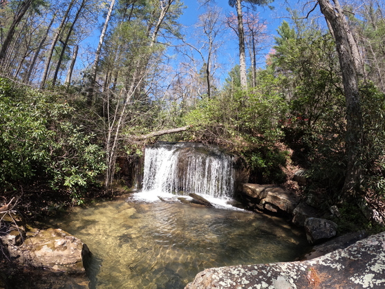
Upper Yellow Cr Falls 12'
Waypoint: MOF059 35.298050,-84.460130
County: Monroe landforms of Monroe county
Locale: Cherokee National Forest
popup list of
nearby landforms (mileage, bearing)
MAPS
Select one of the following maps to display this waypoint (WGS84).
GPS
Remarks:
Reference and photo: Dana Koogler
Tennessee landforms
home
arches
waterfalls
rocks
peaks
balds
sinks
lakes
regions
county
GSMNP landforms (TN/NC)
BSF landforms (TN/KY)
or nearby
lookout towers
 ©
Tom Dunigan
©
Tom Dunigan