Tennessee Landforms -- waterfalls| WGS84 |
| 35.296017 | -84.444017 |
| 35° 17.761'N | 84° 26.641'W |
| 35° 17' 45.7"N | 84° 26' 38.5"W |
| 16S 732420E 3908868N |
| convert to NAD27 |
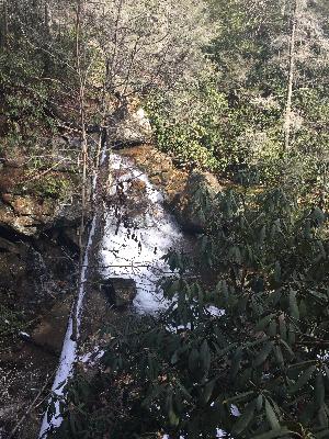
Kamama Falls 17'
Waypoint: MOF049 35.296017,-84.444017
County: Monroe landforms of Monroe county
Locale: Cherokee National Forest
popup list of
nearby landforms (mileage, bearing)
MAPS
Select one of the following maps to display this waypoint (WGS84).
GPS
Remarks:
Reference and photo: Wendy Von Fronk
Tennessee landforms
home
arches
waterfalls
rocks
peaks
balds
sinks
lakes
regions
county
GSMNP landforms (TN/NC)
BSF landforms (TN/KY)
or nearby
lookout towers
 ©
Tom Dunigan
©
Tom Dunigan