Tennessee Landforms -- waterfalls| WGS84 |
| 35.333600 | -84.204200 |
| 35° 20.016'N | 84° 12.252'W |
| 35° 20' 1"N | 84° 12' 15.1"W |
| 16S 754115E 3913626N |
| convert to NAD27 |
Miller Mine Falls 100'
Waypoint: MOF038 35.333600,-84.204200
County: Monroe landforms of Monroe county
Locale: Cherokee National Forest
popup list of
nearby landforms (mileage, bearing)
MAPS
Select one of the following maps to display this waypoint (WGS84).
GPS
Remarks:
Reference & photo: Robert Robbins
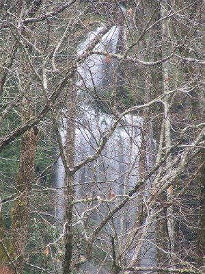
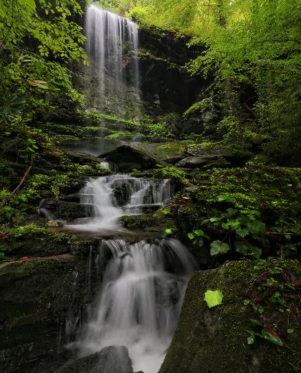 courtesy of Brian Solomon
Tennessee landforms
home
arches
waterfalls
rocks
peaks
balds
sinks
lakes
regions
county
GSMNP landforms (TN/NC)
BSF landforms (TN/KY)
or nearby
lookout towers
 ©
Tom Dunigan
©
Tom Dunigan