Tennessee Landforms -- waterfalls| WGS84 |
| 35.538000 | -84.036250 |
| 35° 32.28'N | 84° 2.175'W |
| 35° 32' 16.8"N | 84° 2' 10.5"W |
| 16S 768704E 3936749N |
| convert to NAD27 |
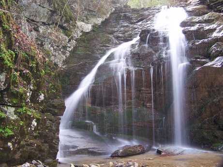
Turkeypen Falls 25'
Waypoint: MOF035 35.538000,-84.036250
County: Monroe landforms of Monroe county
Locale: Cherokee National Forest
popup list of
nearby landforms (mileage, bearing)
MAPS
Select one of the following maps to display this waypoint (WGS84).
GPS
Remarks:
Reference & photo: Robert Robbins
Tennessee landforms
home
arches
waterfalls
rocks
peaks
balds
sinks
lakes
regions
county
GSMNP landforms (TN/NC)
BSF landforms (TN/KY)
or nearby
lookout towers
 ©
Tom Dunigan
©
Tom Dunigan