Tennessee Landforms -- waterfalls| WGS84 |
| 35.321300 | -84.175660 |
| 35° 19.278'N | 84° 10.54'W |
| 35° 19' 16.7"N | 84° 10' 32.4"W |
| 16S 756749E 3912335N |
| convert to NAD27 |
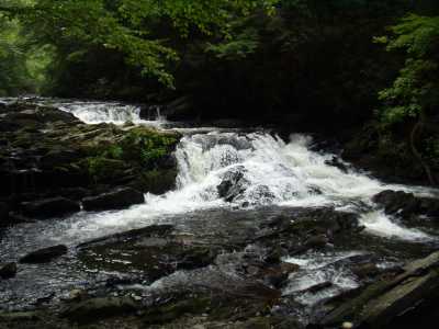
Bald River Cascade 10'
Waypoint: MOF018 35.321300,-84.175660
County: Monroe landforms of Monroe county
Locale: Cherokee National Forest
popup list of
nearby landforms (mileage, bearing)
MAPS
Select one of the following maps to display this waypoint (WGS84).
GPS
Remarks:
Reference:
whitewater info
CNF Trail 88.
Tennessee landforms
home
arches
waterfalls
rocks
peaks
balds
sinks
lakes
regions
county
GSMNP landforms (TN/NC)
BSF landforms (TN/KY)
or nearby
lookout towers
 ©
Tom Dunigan
©
Tom Dunigan