Tennessee Landforms -- waterfalls| WGS84 |
| 35.271800 | -84.139120 |
| 35° 16.308'N | 84° 8.347'W |
| 35° 16' 18.5"N | 84° 8' 20.8"W |
| 16S 760230E 3906939N |
| convert to NAD27 |
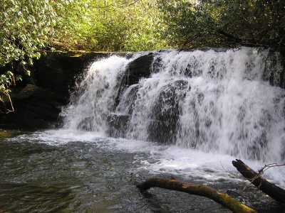
Upper Bald River Falls 15'
Waypoint: MOF014 35.271800,-84.139120
County: Monroe landforms of Monroe county
Locale: Cherokee National Forest
popup list of
nearby landforms (mileage, bearing)
MAPS
Select one of the following maps to display this waypoint (WGS84).
GPS
Remarks:
CNF trail 180. Brookshire Cr Falls is nearby.
Tennessee landforms
home
arches
waterfalls
rocks
peaks
balds
sinks
lakes
regions
county
GSMNP landforms (TN/NC)
BSF landforms (TN/KY)
or nearby
lookout towers
 ©
Tom Dunigan
©
Tom Dunigan