Tennessee Landforms -- waterfalls| WGS84 |
| 35.250730 | -84.377200 |
| 35° 15.044'N | 84° 22.632'W |
| 35° 15' 2.6"N | 84° 22' 37.9"W |
| 16S 738631E 3904002N |
| convert to NAD27 |
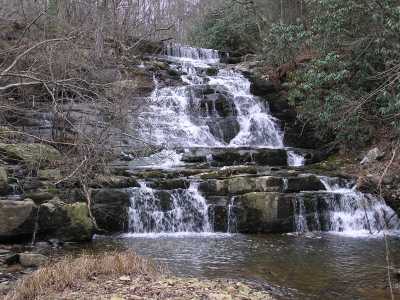
Towee Falls 35'
Waypoint: MOF013 35.250730,-84.377200
County: Monroe landforms of Monroe county
Locale: Cherokee National Forest
popup list of
nearby landforms (mileage, bearing)
MAPS
Select one of the following maps to display this waypoint (WGS84).
GPS
Remarks:
Tennessee landforms
home
arches
waterfalls
rocks
peaks
balds
sinks
lakes
regions
county
GSMNP landforms (TN/NC)
BSF landforms (TN/KY)
or nearby
lookout towers
 ©
Tom Dunigan
©
Tom Dunigan