Tennessee Landforms -- arches and natural bridges| WGS84 |
| 35.530430 | -84.203360 |
| 35° 31.826'N | 84° 12.202'W |
| 35° 31' 49.6"N | 84° 12' 12.1"W |
| 16S 753573E 3935466N |
| convert to NAD27 |
Porthole 1x1
Waypoint: MOA003 35.530430,-84.203360
County: Monroe landforms of Monroe county
Locale: Tellico
NABSQNO 16S-753573-3935466
popup list of
nearby landforms (mileage, bearing)
MAPS
Select one of the following maps to display this waypoint (WGS84).
GPS
Remarks:
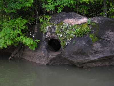 Tellico Lake/blueway
Tennessee landforms
home
arches
waterfalls
rocks
peaks
balds
sinks
lakes
regions
county
GSMNP landforms (TN/NC)
BSF landforms (TN/KY)
or nearby
lookout towers
 ©
Tom Dunigan
©
Tom Dunigan