Tennessee Landforms -- arches and natural bridges| WGS84 |
| 35.599288 | -86.699103 |
| 35° 35.957'N | 86° 41.946'W |
| 35° 35' 57.4"N | 86° 41' 56.8"W |
| 16S 527256E 3939547N |
| convert to NAD27 |
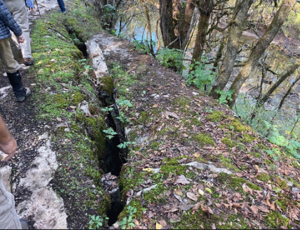
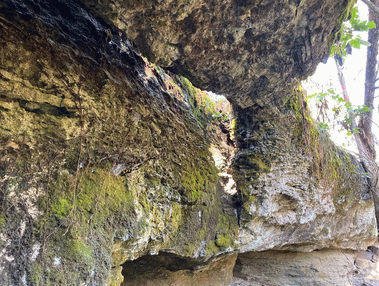
Spring Cr Arch
Waypoint: MLA001 35.599288,-86.699103
County: Marshall landforms of Marshall county
Locale: park
NABSQNO 16S-527256-3939547
popup list of
nearby landforms (mileage, bearing)
MAPS
Select one of the following maps to display this waypoint (WGS84).
GPS
Remarks:
Reference and photos: Keith Garnes
along Spring Creek greenway, Henry Horton State Park
Tennessee landforms
home
arches
waterfalls
rocks
peaks
balds
sinks
lakes
regions
county
GSMNP landforms (TN/NC)
BSF landforms (TN/KY)
or nearby
lookout towers
 ©
Tom Dunigan
©
Tom Dunigan