Tennessee Landforms -- arches and natural bridges| WGS84 |
| 35.140940 | -85.419870 |
| 35° 8.456'N | 85° 25.192'W |
| 35° 8' 27.4"N | 85° 25' 11.5"W |
| 16S 643948E 3889816N |
| convert to NAD27 |
PC Natural Bridge 10x1
Waypoint: MIA004 35.140940,-85.419870
County: Marion landforms of Marion county
Locale: prenticecooper
NABSQNO 16S-643948-3889816
popup list of
nearby landforms (mileage, bearing)
MAPS
Select one of the following maps to display this waypoint (WGS84).
GPS
Remarks:
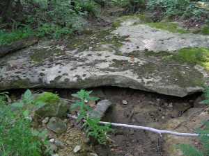 In Prentice Cooper WMA along Natural
Bridge road.
In Prentice Cooper WMA along Natural
Bridge road.
Tennessee landforms
home
arches
waterfalls
rocks
peaks
balds
sinks
lakes
regions
county
GSMNP landforms (TN/NC)
BSF landforms (TN/KY)
or nearby
lookout towers
 ©
Tom Dunigan
©
Tom Dunigan