Tennessee Landforms -- rock formations| WGS84 |
| 36.145700 | -84.497600 |
| 36° 8.742'N | 84° 29.856'W |
| 36° 8' 44.5"N | 84° 29' 51.4"W |
| 16S 725142E 4003010N |
| convert to NAD27 |
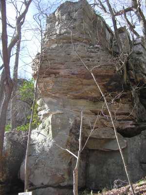
Castle Rock 40'
Waypoint: MGR004 36.145700,-84.497600
County: Morgan landforms of Morgan county
Locale: FrozenHead
popup list of
nearby landforms (mileage, bearing)
MAPS
Select one of the following maps to display this waypoint (WGS84).
GPS
Remarks:
Northwest corner of Frozen Head State Park and on Cumberland Trail
Tennessee landforms
home
arches
waterfalls
rocks
peaks
balds
sinks
lakes
regions
county
GSMNP landforms (TN/NC)
BSF landforms (TN/KY)
or nearby
lookout towers
 ©
Tom Dunigan
©
Tom Dunigan