Tennessee Landforms -- waterfalls| WGS84 |
| 36.008347 | -84.570253 |
| 36° 0.501'N | 84° 34.215'W |
| 36° 0' 30.1"N | 84° 34' 12.9"W |
| 16S 718985E 3987605N |
| convert to NAD27 |
Nsn Falls 10'
Waypoint: MGF035 36.008347,-84.570253
County: Morgan landforms of Morgan county
popup list of
nearby landforms (mileage, bearing)
MAPS
Select one of the following maps to display this waypoint (WGS84).
GPS
Remarks:
Reference and photo: Chris Oliver
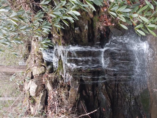 wet-weather falls
Tennessee landforms
home
arches
waterfalls
rocks
peaks
balds
sinks
lakes
regions
county
GSMNP landforms (TN/NC)
BSF landforms (TN/KY)
or nearby
lookout towers
 ©
Tom Dunigan
©
Tom Dunigan