Tennessee Landforms -- waterfalls| WGS84 |
| 36.069734 | -84.746175 |
| 36° 4.184'N | 84° 44.77'W |
| 36° 4' 11"N | 84° 44' 46.2"W |
| 16S 702969E 3994034N |
| convert to NAD27 |
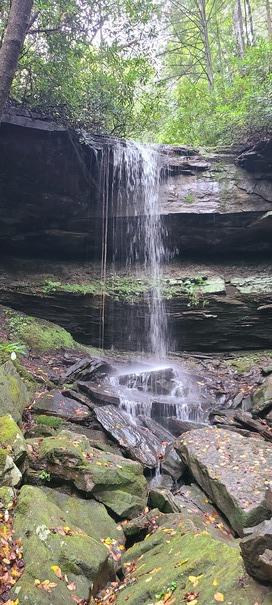
Beaty Falls 25'
Waypoint: MGF033 36.069734,-84.746175
County: Morgan landforms of Morgan county
Locale: CT
popup list of
nearby landforms (mileage, bearing)
MAPS
Select one of the following maps to display this waypoint (WGS84).
GPS
Remarks:
Reference and photo: Shauna Wilson
Tennessee landforms
home
arches
waterfalls
rocks
peaks
balds
sinks
lakes
regions
county
GSMNP landforms (TN/NC)
BSF landforms (TN/KY)
or nearby
lookout towers
 ©
Tom Dunigan
©
Tom Dunigan